FOR SALE
Strategic development site with great potential for housing & other high value uses (STP).
28.3 Hectares (70 Acres)
Location
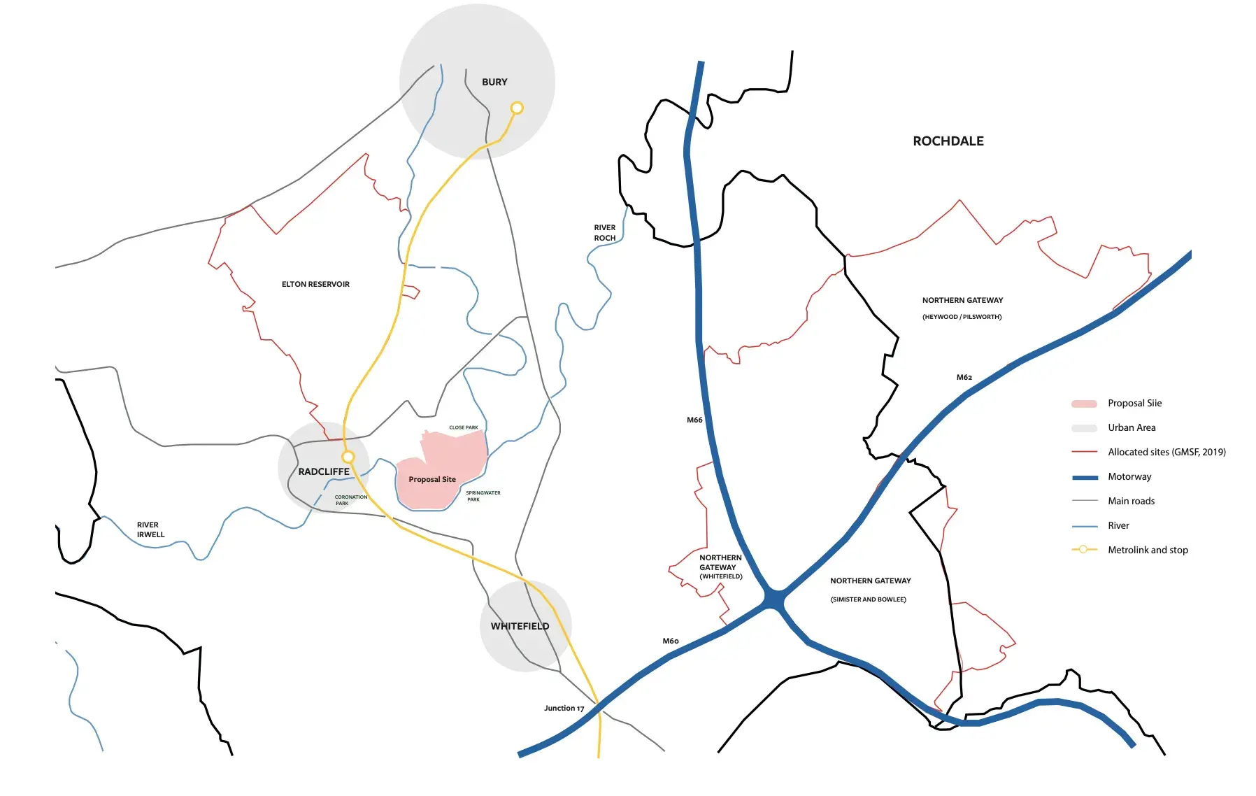
Tower Farm is located to the east of Radcliffe town centre, in the borough of Bury, Greater Manchester. Notable settlements within close proximity to the site include Bury (approx. 2.5 miles to the north east), Bolton (approx. 5.5 miles to the north west) and Manchester (approx. 6.5 miles to the south east).
The site is within close proximity (10min walk) to the Radcliffe Metrolink station which provides access to Manchester City Centre and beyond to Manchester airport. The site is approximately 3 miles from junction 17 which provides access to the M60 motorway and beyond to the M60, M62 and M66 interchange.
Several bus stops are located along Church Street West, Cross Lane, Bury Road and Dumers Lane, these offer services towards Manchester Shudehill Interchange, Bury, Bolton and Farnworth. National cycle route 6 passes to the west of the site which runs in a north – south direction towards Bury and Manchester respectively.
Description
The Site
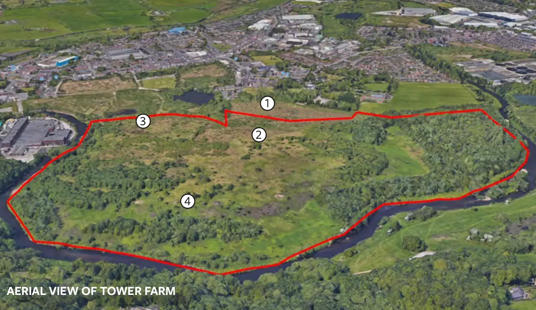
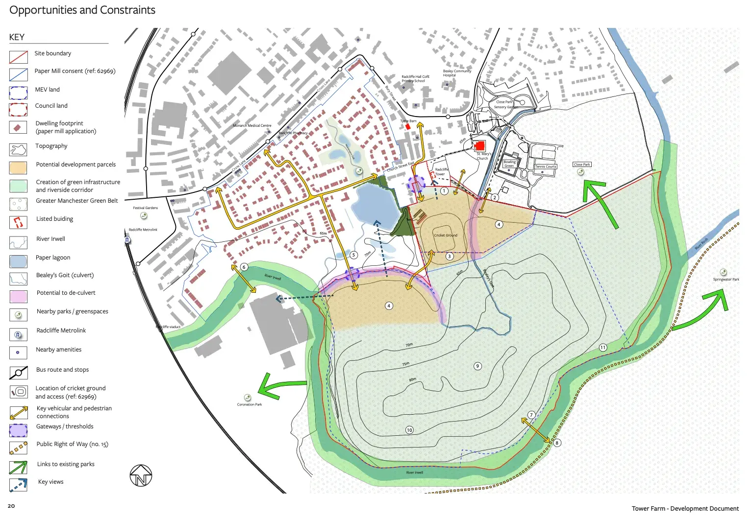
The site lies within the Irwell river valley and is approximately 70 acres with an undulating topography. The site predominantly sits on a former registered landfill associated with the East Lancashire Paper Mill (ELPM); Historical maps indicate that sewage works, sluices and gravel pits were also present on site (a full hictorical analysis is available on request). Evidence of its former use as a landfill are visible today with man made mounds and gas pipes dotted across the landscape.
Tower Farm is entirely washed over by the Greater Manchester Green Belt which is characterised by open fields with areas of woodland towards the south of the site. A culverted river (Bealey’s Goit) meanders through the centre of the site.
Access is currently gained via a single point at Tower Street. A recent outline planning approval (ref: 62969) at the adjacent ELPM site provides an opportunity to create additional access points towards the west of the site. A full review of the ELPM application is available on request.
Local context
The area to the north is primarily characterised by low density residential uses. To the north east of the site is Radcliffe Tower, the church of Saint Mary and Saint Bartholomew, a cemetery and Close Park, a large public amenity space including tennis and bowling courts. Both Radcliffe Tower and Saint Bartholomew are listed as grade I. There are no Listed Buildings on the site itself.
The Irwell river valley characterises the area to the west, east and south of the site, with the valley generally extending in a north east to south west direction. The southern side of the River Irwell is a mixture of parkland and woodland with the urban area of Whitefield located just beyond.
Local amenities
The site is suitably located to benefit from a range of community facilities. Radcliffe town centre is within walking distance (15min) and includes facilities such as; Radcliffe Library, Radcliffe Leisure Centre and several places of worship.
Also located within close proximity to the site is a primary school, a medical centre, Bealey Community Hospital, several GP surgeries, a post office, a day care nursery, two pharmacies, a leisure centre and a dentist.
Other facilities within close proximity include several retail and food outlets, a gym, swimming pool and a number of pubs and takeaways.
Site Areas
The site extends to approximately 28.3 Hectares (70 Acres).
* Check headed opportunities and constraints image
Terms of disposal
We are instructed to seek expressions of interest for the site and the site.
Proposal
We are instructed to seek offers in excess of £2 million for the site.
We have a large amount of supplementary information including topographical data, planning advice, and other useful information that we will make available on request and we are happy to meet with interested parties to run through the files.
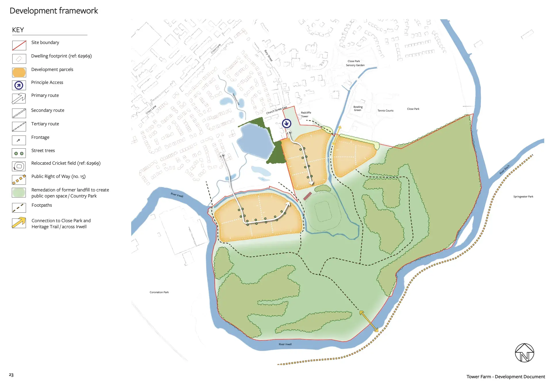
*Check development principles map
Viewing
By prior appointment with the sole agent: Nicholas Haughton Properties: 0161 839 0080.